Lade (crater)
 Lunar Orbiter 4 image | |
| Coordinates | 1°18′S 10°06′E / 1.3°S 10.1°E |
|---|---|
| Diameter | 58 km |
| Depth | 0.8 km |
| Colongitude | 350° at sunrise |
| Eponym | Heinrich E. von Lade |


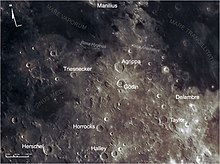
Lade is the remains of a lunar impact crater that has been flooded by lava. Its diameter is 58 km. It was named after German astronomer Heinrich Eduard von Lade.[1] To the north is the crater Godin and to the south-southwest is the worn, lava-flooded Saunder.
The southern rim of Lade has been completely covered or destroyed, and there are gaps in the relatively thin southeast rim. The surviving crater wall is worn and somewhat hexagonal in outline. There is a smaller bowl-shaped crater attached to the interior of the western rim. To the north the crater designated Lade B has been completely filled with lava.
Satellite craters
[edit]By convention these features are identified on lunar maps by placing the letter on the side of the crater midpoint that is closest to Lade.


| Lade | Latitude | Longitude | Diameter |
|---|---|---|---|
| A | 0.2° S | 12.9° E | 57 km |
| B | 0.1° N | 9.8° E | 24 km |
| D | 0.9° S | 13.7° E | 16 km |
| E | 1.9° S | 13.0° E | 21 km |
| M | 1.1° S | 9.4° E | 12 km |
| S | 1.2° S | 8.3° E | 24 km |
| T | 1.0° S | 9.0° E | 18 km |
| U | 0.1° S | 9.6° E | 4 km |
| V | 0.2° S | 9.1° E | 4 km |
| W | 0.2° N | 8.6° E | 4 km |
| X | 1.7° S | 11.0° E | 3 km |
References
[edit]- ^ "Lade". Gazeteer of Planetary Nomenclature. International Astronomical Union. Retrieved 19 August 2017.
- Andersson, L. E.; Whitaker, E. A. (1982). NASA Catalogue of Lunar Nomenclature. NASA RP-1097.
- Bussey, B.; Spudis, P. (2004). The Clementine Atlas of the Moon. New York: Cambridge University Press. ISBN 978-0-521-81528-4.
- Cocks, Elijah E.; Cocks, Josiah C. (1995). Who's Who on the Moon: A Biographical Dictionary of Lunar Nomenclature. Tudor Publishers. ISBN 978-0-936389-27-1.
- McDowell, Jonathan (July 15, 2007). "Lunar Nomenclature". Jonathan's Space Report. Retrieved 2007-10-24.
- Menzel, D. H.; Minnaert, M.; Levin, B.; Dollfus, A.; Bell, B. (1971). "Report on Lunar Nomenclature by the Working Group of Commission 17 of the IAU". Space Science Reviews. 12 (2): 136–186. Bibcode:1971SSRv...12..136M. doi:10.1007/BF00171763. S2CID 122125855.
- Moore, Patrick (2001). On the Moon. Sterling Publishing Co. ISBN 978-0-304-35469-6.
- Price, Fred W. (1988). The Moon Observer's Handbook. Cambridge University Press. ISBN 978-0-521-33500-3.
- Rükl, Antonín (1990). Atlas of the Moon. Kalmbach Books. ISBN 978-0-913135-17-4.
- Webb, Rev. T. W. (1962). Celestial Objects for Common Telescopes (6th revised ed.). Dover. ISBN 978-0-486-20917-3.
- Whitaker, Ewen A. (1999). Mapping and Naming the Moon. Cambridge University Press. ISBN 978-0-521-62248-6.
- Wlasuk, Peter T. (2000). Observing the Moon. Springer. ISBN 978-1-85233-193-1.
External links
[edit]- Lade at The Moon Wiki
- Wood, Chuck (October 18, 2009). "A Bedtime Story". Lunar Photo of the Day.
- Wood, Chuck (December 16, 2014). "A Bedtime Story (repeat of 2009)". Lunar Photo of the Day.
